Chinguetti e o Erg Warane, imersão nas areias
As dunas do erg Warane
Nossa caminhada com camelos na Mauritânia atravessa as majestosas dunas do Erg Warane. Ao longo do caminho, descobrimos palmeirais e chegamos a Chinguetti, cidade histórica respeitada por sua erudição. Continuando para o oeste, exploramos as dunas e sua vida secreta. O maciço de Zarga, com seus arenitos erodidos e sua história singular, enriquece nossas noites sob as estrelas.
Trip Description
Accomodation
Stay program
day 1
Aeroporto de Paris - NouakchottProposta de voo indicativa: Royal Air Maroc. Partimos no final do dia para a capital mauritana via Casablanca, em Marrocos. Uma vez concluídas as formalidades, recebemo-lo no hall do terminal de Nouakchott. Após um curto transfer para a cidade, chegamos ao nosso hotel no meio da noite para um merecido descanso.
day 2
Partida para o planalto de Adrar.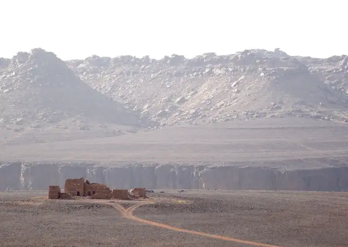
Depois de deixar a cidade e seus subúrbios, seguimos pela estrada asfaltada que vai para o nordeste em direção à cidade mineira de Akjoujt. A região do Trarza e a costa atlântica já ficaram para trás, dando lugar a uma vegetação cada vez mais saariana. As grandes planícies arenosas do Inchiri nos conduzem até Akjoujt, uma cidade um tanto surreal onde a indústria mineira está presente desde o Calcolítico, com o homem extraindo cobre, ouro e outros materiais preciosos. Progressivamente, a paisagem muda e entramos na região do Amsaga. A leste, a barreira escura do Adrar começa a se desenhar. Atravessamos a grande planície aluvionar de Yagref e passamos pela aldeia de Aïn Ahel Taya. A estrada cruza o primeiro ressalto do Adrar. A partir de Atar, a transferência em veículo 4x4 para encontrar nossa equipe de camelos dura cerca de 2 horas. A trilha para subir ao planalto principal do Adrar está atualmente muito boa, com o último terço ocorrendo na borda norte da zona arenosa. O primeiro acampamento é estabelecido ao norte do maciço de dunas de Afam el Mezrougat. É aqui que encontramos a equipe de camelos moura com quem compartilhamos estes dias na Mauritânia. Eles pertencem a uma tribo do leste do Adrar.
day 3
A pé sobre as dunas douradas e o oued Chinguetti.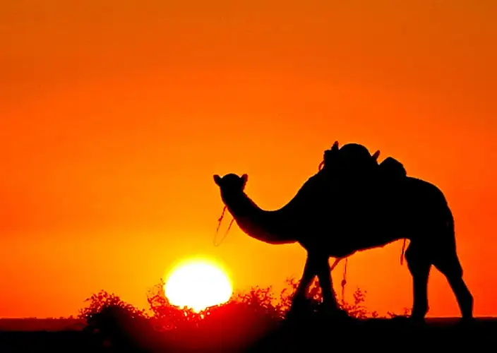
A pé, atravessamos o maciço de dunas de Afam el Mezrougat, composto por duas elb, para alcançar a batha Chinguetti, um rio seco e arborizado, propício para culturas sazonais. Em seguida, chegamos às grandes dunas do erg Warane, na margem direita do oued, onde montamos nosso acampamento perto dos primeiros palmeirais, marcando o início da zona habitada do oued Chinguetti. Nossos acampamentos saarianos agora oferecem tendas espaçosas do tipo khaïma mauritana para duas pessoas, garantindo conforto e autenticidade. Para os amantes das noites sob o céu estrelado, é possível dormir ao ar livre. Cada viajante se instala livremente ao redor do local de convivência definido pela instalação das camelas e da cozinha saariana. Você dispõe de um colchão de espuma confortável com uma capa de lona e um tapete de chão. Para todas as viagens, preveja um saco de dormir quente e um lençol de saco para se cobrir levemente durante as noites quentes e se proteger do vento de areia e dos mosquitos.
day 4
Os Aklés do erg Warane e Chinguetti, a doce.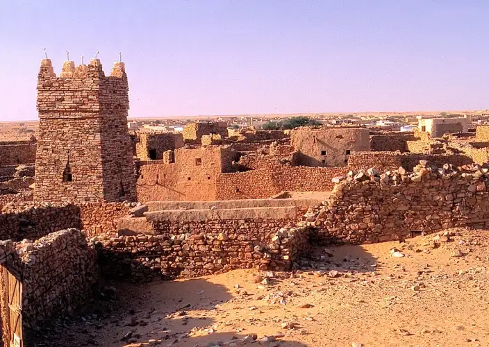
Os aklés da borda norte do erg Warane nos permitem chegar à antiga cidade de Chinguetti no meio do dia. Atravessamos as dunas e fazemos uma bela parada em um palmeiral para chegar no meio da tarde. Uma visita está prevista para o final do dia para descobrir a cidade velha, as bibliotecas, os palmeirais e os jardins. Nosso ponto de descanso para a noite é uma pousada confortável onde tomaremos nossa refeição da noite. Chinguetti foi fundada pelos Ida Ouali por volta de 1525, a montante de Abweyr, hoje desaparecida. Seu topônimo pode vir do soninké: si (poço) + n (de) + gede (cavalo), significando "poço do cavalo". Foi o centro comercial mais ativo e a cidade mais importante do Saara Ocidental, considerada a 7ª cidade sagrada do islã com suas 11 mesquitas, seus 100 poços e seu círculo de sábios. Em 1675, um massacre perpetrado por uma parte dos Ida-ou-Ali levou à divisão do grupo, cujos sobreviventes fundaram Tidjikja no Tagant. Hoje, resta apenas uma mesquita e a lembrança dos períodos prósperos. As principais tribos são os Ida-ou-Ali, os Laghlal e os Oulad Gheilan. Chinguetti e Wadâne, com suas ruelas estreitas e tortuosas, seus numerosos becos sem saída, suas casas baixas e escuras feitas de materiais locais, e sua quase ausência de praças e espaços comunitários, têm uma estrutura de antigos ksour densamente agrupados ao redor de suas mesquitas.
day 5
No coração do Erg Warane
Em direção ao sudoeste, enfrentamos uma longa e bela série de montanhas de areia, os M’ghalig, que dominam vales interdunares, tradicionais rotas das caravanas comerciais entre o norte e o sul, onde se encontram os raros poços. A pausa do meio-dia está prevista em La Gueïla, um pequeno oásis de palmeiras pertencente aos notáveis de Chinguetti. Prosseguimos nossa jornada rumo ao oeste nas dunas, onde uma vegetação específica dos grandes ergs se desenvolve, como a Acacia raddiana e as Balanites aegyptiaca. Montamos nosso acampamento em um desses poderosos maciços de areia. Os pastos arborizados alternam com as dunas, colonizadas pela vegetação após chuvas suficientes. A flora saheliana e saariana é abundante, com espécies como o mrokba, o sbot e o girgir. As árvores são numerosas, especialmente nos vales: teichot, atil, ifernan, sder, turjit e diversos acácias. Um arbusto se destaca por suas flores particularmente perfumadas, o Boscia senegalensis.
day 6
Do fim do erg aos arenitos tassilianos de Zerga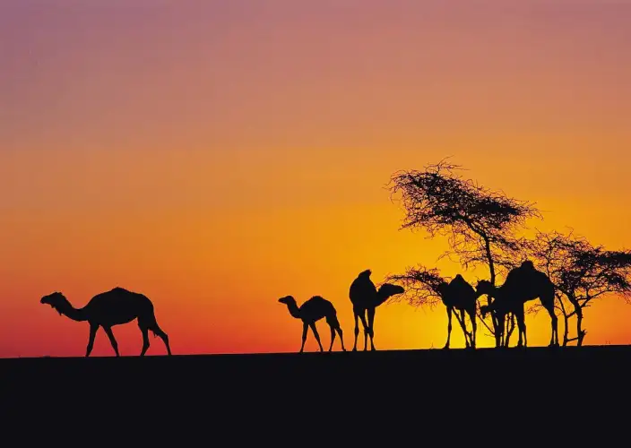
Os imponentes maciços nos encaram, com as cristas negras do megacordão de Zarga começando a se desenhar. Tinouarderit, um pequeno uádi arborizado, marca a parte ocidental do erg. Um teïchot (Balanites aegyptiaca) sombreado nos recebe para uma pausa. Subindo o leito do uádi, alcançamos uma pequena zona de barkhanes, onde o Erg Warane termina sua corrida para o oeste. Sob o nome de Erg Amatlich, ele reaparece na borda oeste do Adrar, continuando seu impulso em direção ao Atlântico. A Mauritânia continua sendo um grande país de nômades. Ao longo do percurso, especialmente quando o pasto está bom, é possível avistar tendas de nômades, marrons ou brancas, cujas bordas são levantadas em tempo quente ou sem vento. Esses nômades geralmente são acolhedores, mas é costume visitá-los apenas por uma razão importante. Às vezes, temos a oportunidade de entrar sob uma tenda para beber um chá (três copos!) e o zrig, uma mistura de leite fresco ou azedo e água açucarada. Os rebanhos de camelos, camelas, cabras, ovelhas, bovinos e burros estão por toda parte. Na estação quente, mesmo que o pasto esteja verde, é fascinante observar a dessedentação desses animais que esperam pacientemente sua vez nos poços ou oglats.
day 7
Os arenitos de corredor de Zarga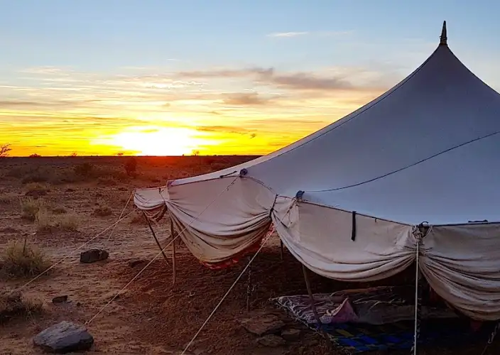
Regressamos ao pequeno maciço arenítico de Zarga, com 80 km de comprimento, que forma o leito fóssil de um antigo rio glacial. Seus arenitos com corredores criam um labirinto de ruas e abrigos sob a rocha, abrigando uma fauna e flora ricas, bem como pinturas. Este cordão é uma barreira climática eficaz: sua ponta norte e sua altitude bloqueiam as perturbações atlânticas e a monção africana, favorecendo uma pluviosidade mais importante e uma vegetação saariana com influências mediterrâneas ou sudanesas. Encontram-se ali espécies como Boscia senegalensis, Euphorbia balsamifera, Combretum aculeatum e lavandas perfumadas. Este maciço é um esker de cerca de cem metros de altura e cerca de 50 km de comprimento, resultado de uma aventura geomorfológica com 440 milhões de anos. Hoje, o megacordão fóssil de Zarga marca o fim ocidental do erg Warane, barrando o escoamento das areias vindas do erg Chech. Contrariado por esta barreira natural, o erg Warane muda de nome para tornar-se Amatlich, depois Akchar, antes de se perder nas águas do oceano Atlântico.
day 8
Tichilit el Ateg, o ponto alto da nossa caminhada.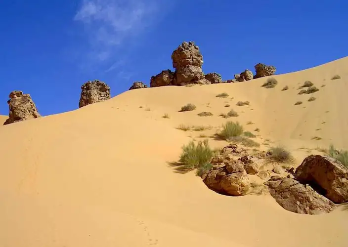
Ao permanecermos a leste do maciço de Zarga, chegamos ao poço de Niesle e, pelo sopé oriental, alcançamos Tichilit el Âteg, o ponto culminante do maciço e o terceiro pico do Adrar, que esconde uma magnífica duna de cobertura. Aos seus pés, uma ampla bacia aluvional abriga culturas e nômades. Aproveitamos para saborear estes lugares magníficos, marcando o apogeu da nossa jornada entre dunas e rochas. À tarde, retornamos a Atar por uma trilha pouco transitável. Depois de passar algum tempo em Atar, continuamos nosso caminho em direção a Azougui, a antiga capital almorávida. As ruínas desta cidade estão localizadas a noroeste de Atar, em um belíssimo vale chamado Tayyaret.
day 9
Regresso a Nouakchott, depois voo direto para Paris.Partimos em direção ao oeste, deixando para trás os últimos planaltos do Adrar para alcançar a depressão de Yagref. As paisagens do Amsaga são marcadas por cones de rochas negras e as cordilheiras de dunas do Amatlich. Depois, as vastas planícies do Inchiri nos conduzem até a costa Atlântica e à capital mauritana. Em Nouakchott, de acordo com os horários do seu voo para a França, garantimos o seu transfer para o aeroporto internacional de Nouakchott-Oumtounsy.
- Duration : 9 days
- Price : From €830 per person
- Destinations: : Mauritânia
A website by
Customize your trips with Quotatrip and receive tailor-made offers directly in your inbox.